Park Naming Survey and New Parks Information
Alameda Landing Waterfront Park
Background
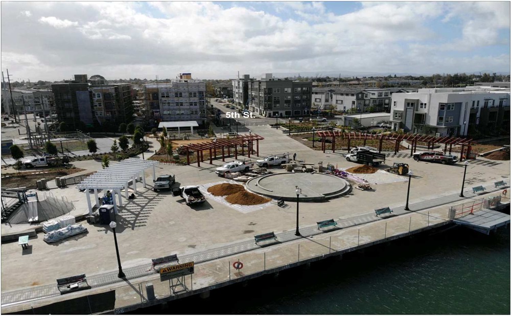
The Alameda Landing Waterfront Park is located at the end of 5th Street, just off Mitchell Avenue on the Alameda Oakland Estuary. This park is unique in that most of it is on a pier. The park includes a playground with a ship theme, group picnic area, chess and corn hole games, fish cleaning station, dock for non-motorized watercraft and a water taxi shuttle, large open concrete area for events, fitness equipment, connection with the SF Bay Trail, and seating along the public water promenade. This park will serve the residents of new and existing homes in Alameda Landing and is a connection for the San Francisco Bay Trail through to Estuary Park.
This section of Alameda is known as the Fleet and Industrial Supply Center (FISC). This area of Alameda was originally undeveloped marshlands and tidal flats of the San Francisco Bay. During the 1800s to the 1960s, this land was created by filling these areas with dredged materials from Seaplane Lagoon, San Francisco Bay, and Oakland Inner Harbor.
From 1920 to 1941, the area was a commercial airport. The federal government purchased the land in 1941 and was constructed from 1944 - 1945 by the U.S. Army Corps. The Army Air Forces conducted operations from
1945 - 1948 and used the site as a supply center to support military operations. In 1951, the site’s use changed and it became the Alameda Medical Depot including cold storage facilities with a mission to procure, store and distribute perishable food. From 1955 - 1962, the Quartermaster General, Washington D.C. managed the site as the Alameda Administration Center. [Historical information cited from 1) US Army Corps of Engineers History - Fleet Industrial Supply Center Alameda Annex, 8/21/2017 and 2) Dept of the Navy Base Realignment and Closure Fact Sheet - 5-Year Review of Alameda Point and Fleet and Industrial Supply Center Oakland, Alameda Facility/Alameda Annex Alameda, California, November 2011]
Alameda Point Neighborhood Park
Background
The Alameda Point Neighborhood Park is located on Coronado Ave. and spans three blocks between Ardent Way and Main Street. It is intended to serve new and existing residents of Alameda Point. Park amenities include a playground, group picnic area, seating throughout the park, open lawn areas, basketball hoop, corn hole and fitness equipment. The playground was designed with an aquatic theme including a large whale playground structure and pirate ship. The inspiration for this whale is Allie, a humpback whale that spent time in Seaplane Lagoon in the summer of 2019.
Historically, Alameda Point was the Naval Air Station (NAS) Alameda. This was an active military facility starting before World War II. “The base provides berthing for Pacific Fleet ships and is a major center of naval aviation. The facility includes an airfield, seaplane lagoon, hangars, repair facilities, and residential areas for military personnel. The most dominant feature of the base is the intersecting runways in the airfield area. The runways are visible from the Bay Bridge and other vantage points around San Francisco Bay.” [Excerpt from the 1996 NAS Alameda Community Reuse Plan]. The Navy closed the base in 1997 and this park is within the first major Alameda Point redevelopment site known as Site A. Prior to the NAS, this land was primarily tidelands and marshlands and was traditional Lisjan Ohlone land. A large shellmound was located at Alameda Point and was dismantled with the shells and bones being used for the runway construction.
Alameda Point Waterfront Park
Background
The Alameda Point Waterfront Park is located at the turn of Ferry Point and is intended to be a passive waterfront promenade park. It boasts incredible views of Seaplane Lagoon, naval ships including the U.S.S. Hornet and the San Francisco Bay. The park is located across from the Naval Aviation Museum. It is the first phase of multiple phases that ultimately will build out the entire northern edge of Seaplane Lagoon as a waterfront promenade with the western edge being De-Pave Park, an ecological nature park.
This park was first envisioned in the 2013 Alameda Point Town Center and Waterfront Precise Plan. The site consists of a large concrete promenade along the water’s edge with three tiers of landscaping and seating. The top area includes many picnic areas, public art, grass areas, and a synthetic turf lawn for classes and play area. The tiered design is intended to work with sea-level rise with the lower promenade being flooded as the ocean rises.
Historically, Alameda Point was the Naval Air Station (NAS) Alameda. This was an active military facility starting before World War II. “The base provides berthing for Pacific Fleet ships and is a major center of naval aviation. The facility includes an airfield, seaplane lagoon, hangars, repair facilities, and residential areas for military personnel. The most dominant feature of the base is the intersecting runways in the airfield area. The runways are visible from the Bay Bridge and other vantage points around San Francisco Bay.” [Excerpt from the 1996 NAS Alameda Community Reuse Plan]. The Navy closed the base in 1997 and this park is within the first major Alameda Point redevelopment site known as Site A. Prior to the NAS, this land was primarily tidelands and marshlands and was traditional Lisjan Ohlone land. A large shellmound was located at Alameda Point and was dismantled with the shells and bones being used for the runway construction.
Alameda Marina Park
Background
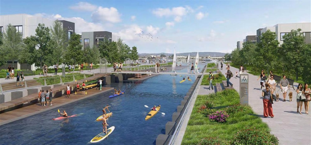
The Alameda Marina Park is located on the Alameda/Oakland Estuary between Grand Street and Willow Street along the Alameda Northern Waterfront. The park includes continuation and realignment of the San Francisco Bay Trail, open lawn areas, waterfront promenade, seating and picnic areas, and a long floating dock to launch, store and instruct on non-motorized watercraft such as kayaks, small sailboats, and paddleboards.
Alameda Marina has a long history as a working waterfront. In 1916 the Barnes and Tibbitts Shipbuilding & Drydock Company opened at the site adjacent to the Alaska Packers. They built a 360-foot wharf and large slips called marine ways. Subsequent owners utilized the site for activities including large ship repair and building ships, including Golden Gate ferries for the Southern Pacific Railroad, gunboats for the Coast Guard, and boats for the Navy. The Navy purchased a section of the land around 1947 and then declared the boatyard surplus property in 1959. [historical information from the Alameda Sun, January 10, 2017]. Since then, Alameda Marina has served as a marine maintenance and storage facility. The Alameda Municipal Power headquarters is directly adjacent to Alameda Marina, located at Grand Street and Clement Avenue.